With more than 800 miles of trails weaving throughout the Great Smokies, there are virtually limitless hiking opportunities.
The hiking trails system in the Great Smokies offers so much to see and experience including epic ascents to spectacular views, paths that lead to breathtaking waterfalls, and walkways lined with hundreds of blooming wildflowers.
Here are nine of the best hiking trails in Great Smoky Mountains National Park.
Alum Cave
- Length : 4.5 miles
- Difficulty : Moderate
- Estimated Time : 7 to 8 hours
- Best Time : May
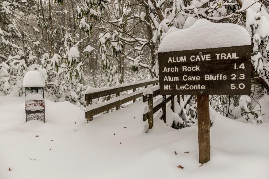
Alum Cave is the most popular trail in the park and for a good reason. While other trails may offer spectacular waterfalls, Alum Rock features amazing rock formations and spectacular views.
At just over a mile in, you’ll reach the arch rock, which you hike under via steps carved out of the rock. After another mile, you’ll enjoy views from Inspiration Point, including the Eye of Needle hole atop adjacent Little Duck Hawk Ridge.
A little further on is Alum Cave, which is more of a large rock overhang that resembles a cave. The trail continues on for another five miles as it ascends Mt. LeConte.
Along the way, you’ll take in numerous amazing views while crossing creeks. Leconte Lodge is located at the summit of the mountain, where you can find something to eat and even an overnight stay if you book far enough in advance.
Laurel Falls Trail
- Length : 2.4 miles
- Difficulty : Easy
- Estimated Time : 1 to 2 hours
- Best Time : May
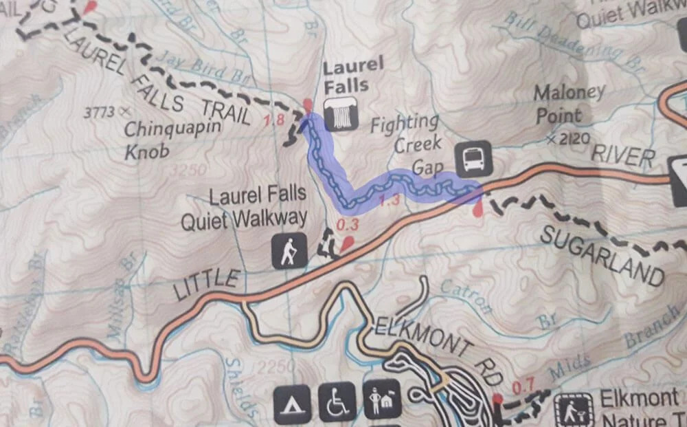
With its main feature being one of the most beautiful waterfalls in the park, Laurel Falls is perhaps the most popular trail in the park.
The trail is about 2.4 miles in length and ascends about 300 feet in elevation before arriving at an 80-foot waterfall. The waterfall features an upper and a lower section, which is divided by a walkway. If you hike the trail in May, you’ll be treated to blooming laurel along the trail as you make your way to the falls.
Its easy terrain makes this an extremely popular trail for families with young children due to its relatively easy terrain. There are, however, some hazards to be aware of when hiking the trail. Be mindful of steep drop-offs adjacent to some sections and be wary of black bears, which are commonly sighted near the trail.
Abrams Falls Trail
- Length : 5.2 miles
- Difficulty : Moderate
- Estimated Time : 2 to 3 hours
- Best Time : May
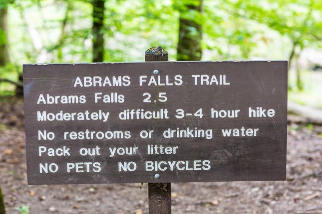
Abrams Falls ranks as one of the most spectacular falls in the park.
After crossing a footbridge, the trail follows a ridge top through pine forests while skirting Abrams Creek, though you won’t see much of it thanks to dense rhododendron. A
t about 2.5 miles in, you’ll hit a side trail that takes you over a footbridge to a viewing area of Abrams falls.
While the waterfall’s height is not impressive at just 20 feet, the massive amount of water flowing over these falls is. It also makes this waterfall extremely dangerous and is the reason why dozens of people have drowned here since the 1970s. Swimming here is extremely dangerous and should not be attempted.
The falls make this trail an extremely popular attraction, so consider hiking it early in the morning to avoid the crowds.
Chimney Tops
- Length : 3.3 miles
- Difficulty : Moderate to hard
- Estimated Time : 2 hours
- Best Time : June
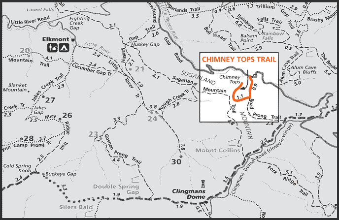
Chimney Tops offers amazing views, making it one of the most popular hikes in the park, but it will make you work to earn them.
With its short distance of 3.3 miles round trip, you might wonder how this hike gets its moderate rating. That would be because of its terrain. The trail begins by crossing a beautiful fast-moving creek. This is a great place to cool off in the summertime.
The first half of the trail offers a gentle climb before hitting you with a steep ascent covering nearly 1,000 feet in less than a mile. This steep grade at one point resulted in erosion that rendered the trail virtually impassable. A massive renovation effort in 2012 fixed that by adding stone steps and wooden bridges.
While you can no longer ascend to the pinnacle of the Chimney Tops, which involved a scramble on all fours over a rock face, there is an observation area about a quarter-mile below the top that affords you amazing views of Mt. Leconte and the pinnacle.
Gregory Bald Trail

- Length : 11.3 miles
- Difficulty : Hard
- Estimated Time : 8 hours
- Best Time : June
Gregory Bald offers amazing views at any time during the year, but for the full experience on this trail, you need to go in mid to late June when its legendary azaleas are in full bloom, turning the bald into a dazzling display of reds, pinks, and oranges.
Typically a hike of this length and difficulty level means you’ll have a somewhat solitary experience, but if you go at this time expect to see dozens of other hikers. And what a hike it is.
Make sure you pack quality hiking shoes as you’ll need the support. Hiking poles are also recommended to aid in the steep climb.
While the first few miles of this hike are somewhat moderate, at about 2.5 miles in, the trail begins its rapid ascent, climbing some 2,000 feet over the final three miles to the bald.
Ramsey Cascades
- Length : 8 miles
Difficulty : Moderate to hard
Estimated Time : 7 to 8 hours
Best Time : May
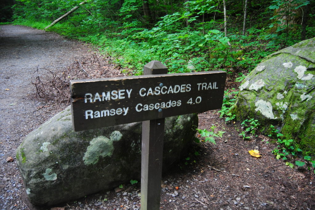
This moderate to strenuous eight-mile hike will carry you more than 2,000 feet upwards to one of the best-known waterfalls in the park.
Start out by following a gravel road before picking up a narrow path that takes you through one of the oldest growth forests in the entire park. Here, you’ll encounter some of the park’s largest trees, including a black cherry tree that reaches more than 150 feet high.
At two miles, cross a long footbridge that spans a creek before reaching the final stretch, which is a strenuous scramble over rocks and boulders. Make sure to bring along a stout pair of hiking boots. The trail ends at Ramsey Cascades, which is a waterfall that drops some 100 feet, making it the park’s largest.
Mt. Cammerer
- Length : 11 miles
- Difficulty : Hard
- Estimated Time : 8 to 9 hours
- Best Time : May
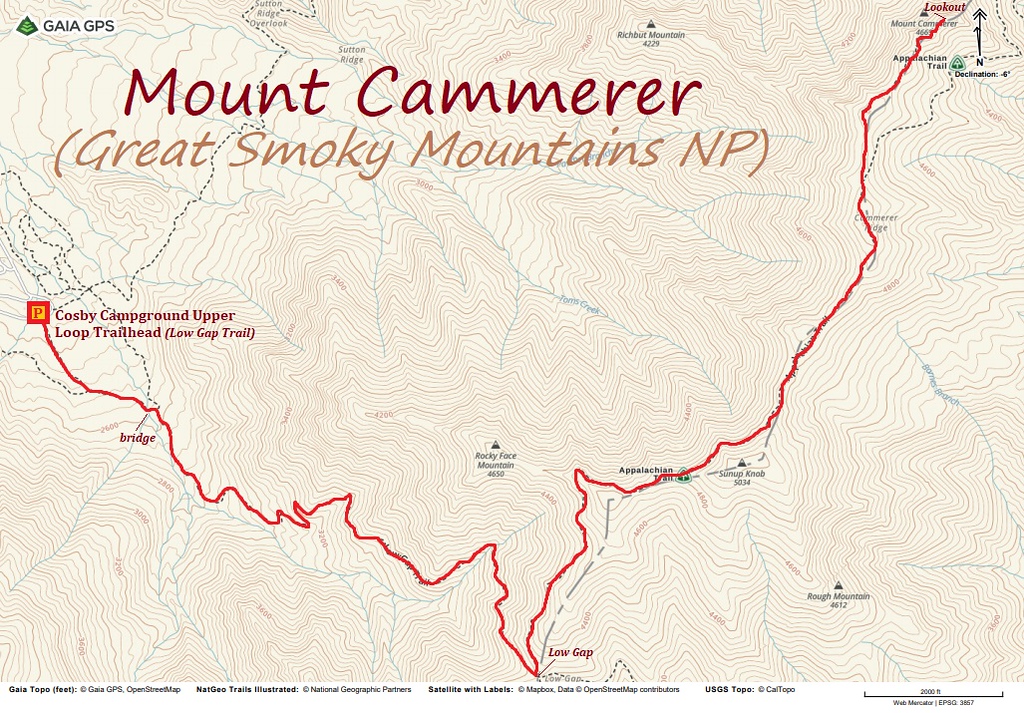
This strenuous climb up to the summit of Mt. Cammerer will see you ascending more than 3,000 feet over 5.5 miles.
The steep start of this hike takes you up Low Gap Trail with steep switchbacks through beautiful hardwood forest. After hooking up with the Appalachian trail about three miles in, you’ll continue on a more moderate climb to the top of the ridge.
Once you’ve reached the ridgeline, at more than 5,000 feet above sea level, you’ll take in views of Cosby Creek Valley and Toms Creek Valley. A spur trail leads to the summit of Mt. Cammerer, which is a short but difficult ascent over difficult rocky terrain. A tower at the summit offers amazing 360º views of the surrounding mountains.
Rocky Top Trail
- Length : 14 miles
- Difficulty : Moderate
- Estimated Time : 7 to 8 hours
- Best Time : June
Rocky Top offers incredible mountain views and stunning paths that wind through rhododendrons, incredible wide-open meadows, and beautiful balds.
Make sure to pack appropriate hiking boots and hiking poles as you’ll be ascending more than 3,500 feet on this hike. The ascent incorporates three trails; Anthony Creek, Russell Field, Bote Mountain, and the Appalachian Trail as you make your way to the summit of Rocky Top.
Along the way, you’ll be treated to wildflowers in the summer, large boulders, and wide-open meadows. Once at the top, you’ll cross three summits with the final one being the highest point on Thunderhead Mountain at 5,527 feet.
The journey is a difficult one but the climb is worth it as the views at the top are considered among the best in the entire park.
Porters Creek Trail
- Length : 4.5 miles
- Difficulty : Moderate
- Estimated Time : 7 to 8 hours
- Best Time : May
Porters Creek Trail is a family-friendly hike that offers as much if not more to see than some of the more difficult hikes in the park.
While some of the best trails in the park involve moderate to strenuous climbs, not all of them do.
This 2-mile hike features incredible scenery, with the first mile skirting the banks of the bubbling Porters Creek. Just past the first half mile you’ll encounter what remains of the Elbert Cantrell farmstead and Ownby Cemetery, which are part of a community settled in the early 20th century.
After crossing a footbridge about a mile in, you’ll reach Fern Branch Falls, a 40-foot tall waterfall that serves as the main highlight of the hike. While many visitors turn back once reaching the falls, continue on for another 2 miles before making the trek back.
Amanda Williams
Amanda Williams is a writer, plant-nerd, and outdoor enthusiast. She has traveled extensively, around the U.S., throughout Asia, Europe, and Latin America. Everywhere she treks, she takes time to enjoy the outdoors. John Muir is her hero. She aspires to inspire people to live better as he did.
